According to the book "Roadside Geology of New York", the Adirondack Mountains are composed of rock as much as three billion years old. That rock crashed into the Eurasia continent, drifted back apart, was uplifted, eroded, redeposited, metamorphosed, uplifted again, carved by glaciers... Day after day, the sun rose and set, spring winds scoured, summer heat baked, fall rains fell, and winter's cold penetrated. Year after year after year. Three billion times. No wonder the rocks cracked.
In June of 2019, Doug and I went on an adventure to investigate two of these cracks.
We leave Ithaca at a moderately early hour, navigate our way through swarms of Harleys out enjoying the sun, and arrive at the Rogers Rock Campground. We get in line...
to rent a canoe!
to rent a canoe!

The first crack we plan to climb is a 600 foot cleft rising almost directly out of the water on the west shore of Lake George. So we rent our boat, strap our packs to the thwarts (it would make us sad to capsize, it would make us even more sad to lose our ropes and gear to the bottom of the lake), and paddle north.
The aptly named Little Finger Route is justifiably popular, and we're not surprised to find a pile of canoes and kayaks pulled up into the woods at the base of this climb. We do some fancy footwork to clamber onto the boulders that serve as a dock, pull the canoe up, and settle down to wait at the end of the climbing conga line.

This route is popular for the same reasons that I like it: it follows a crack, so even I will have a hard time getting off route, it follows a crack so there are ample opportunities to place protection, it follows a crack with anatomy friendly dimensions and geometries so fingers, ring locks, hand jams, and side pulls feel solid even to me, and there are enough features on the face to keep feet happy without ankle contortions (which I will talk about again a few paragraphs below).
I have come to accept that I will never be much of a lead climber. My first multi-pitch lead was in the Gunks, rated 5.5 Now, years and many pitches later, I lead...
5.5 and still sometimes scare myself silly. At this rate I'll be climbing 5.5in no time, for all time.
So, it should come as no surprise that this three pitch route with gorgeous scenery, is rated... 5.5 : )
I have come to accept that I will never be much of a lead climber. My first multi-pitch lead was in the Gunks, rated 5.5 Now, years and many pitches later, I lead...
5.5 and still sometimes scare myself silly. At this rate I'll be climbing 5.5
So, it should come as no surprise that this three pitch route with gorgeous scenery, is rated... 5.5 : )
I'm also a slow leader: slow moves, slow gear placements, slow anchor building, slow rope management.
In comparison, the party ahead of us is, how to put this diplomatically...
In comparison, the party ahead of us is, how to put this diplomatically...
slower than the geologic processes that created the rock and cracks! The party of three employs, how to put this diplomatically... unusual procedures. Their leader climbs up, builds an anchor, puts the second on belay, then pulls all the slack through their belay device. It would be much more efficient to pull the slack up, then rig the belay device like this. They're too far to see, but based on the speed at which the rope moves up, they must be using a pull, brake, under, slide, pause, pause, pause, pause, pull, brake... method.
Doug and I eat lunch and take a nap. When we wake up, hooray! their second climber is at the anchor. Then after more pauses, their belayer puts their third climber on belay, and... pull, brake, under, slide, pause, pause... A more efficient way is to belay two followers simultaneously like this. Doug and I take another nap and ponder dinner.
We know that we should wait longer as the party ahead of us heads up the second pitch, but we're starting to seize up. So, Doug leads off, builds an anchor and belays me up.

There's no ledge at this station, so we hang in our harnesses, shifting our feet around trying (unsuccessfully) to find a position that doesn't fold our ankles in half.
Turns out what we want is squirrel ankles. Squirrels have swiveling back ankles! that rotate 180 degrees, allowing them to hang upside down. I've been watching squirrels for a long time, and never thought to question how they do that.
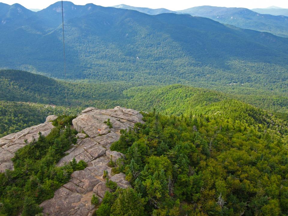
Instead of swiveling our ankles, we get incredibly stiff and sore from the calves down. It's so painful that when I lead the next pitch, I wonder if I'll be able to climb the next day. Luckily, there's a bit of a ledge at the next belay station, and we knead our unhappy parts while we wait. It's hard to complain when waiting consists of hanging out having fun conversations and sharing snacks in a setting like this:

Eventually, we see the other party rappelling, so Doug leads off again. I glance down at the party at a lower rappel station just as they start to pull their rope. I notice they've done a good job about tying a stopper knot in the end of their rope. The reason I notice this, is because as they're pulling down one end of their rope, the other end, still with a knot in it, is slithering up the cliff destined to be stuck in the anchor chains. Luckily, this time they could wait until Doug climbs up and he could release their rope. But in general, a stuck rope is serious business. Here's some information about how to deal with a rope that is stuck above your rappel. Luckily, I alert them to the problem, they're able to scramble up, pull their rope down, untie the knot, and with a thanks and wave, they're on their way again.

Doug and I finish our climb, celebrate with a couple of masculine chest bumps (not really, and no I have not actually watched this how to video).
By now, the sun is dropping like a stone toward the horizon, so no time to tarry. We discuss and decide to simul -rappel. This is a method that can be quicker than rappelling one at a time, but it entails risks as with any climbing procedure. One reason I like Doug so much as a trip partner is because we are both highly respectful of our own stupidity. So we check and cross check every step, including verifying that the stopper knot is untied before we pull the rope.
By the time we get down, dusk is settling over the lake. We pack up gear, paddle back to the campground, and find the rental office is closed. We leave the canoe and paddles with a note and hope nobody steals the stuff before the staff come in the morning.
By the time we get down, dusk is settling over the lake. We pack up gear, paddle back to the campground, and find the rental office is closed. We leave the canoe and paddles with a note and hope nobody steals the stuff before the staff come in the morning.

We now drive north and west to put ourselves in position for our next adventure, climbing a big crack. We head towards the Adirondak Loj, gateway to several of the 46 High Peaks. Before reaching the Loj parking lot, we turn left onto South Meadow Road. There are several free camp sites along this cobble strewn track. A dirtbag's dream! Unfortunately, all the official sites are occupied. Luckily, there seems to be an accepted practice of stuffing a vehicle into any slight gap in the trees that crowd the lane, and setting up a tent on any patch of ground that you're willing to sleep on. So that's what we do. After the long day, a quick snack serves as dinner, and soon we're asleep.
In the morning, neither of us require formal breakfast or complicated beverage rituals, so after quickly packing up our camp, we start walking towards our climbing objective, Mount Colden.
The first few miles of our route is south along the Marcy Dam truck trail. Wide enough for the passage of service vehicles, the track allows the unique opportunity to walk side by side. Our repartee is improved by approximately 76.3% compared to talking while hiking on a normal Adirondack trail. When you converse with someone under normal circumstances, you point your mouth at their ears, and they do the same thing. When walking in tandem along a hiking trail, the person in front points their mouth away from the person in back, and the person in back points their mouth at the back of the leaders head. Both people have a hard time being heard, so over half of the banter consists of "what?"
With this unprecedented opportunity to commune, the miles pass quickly and we arrive at Avalanche Lake. The weather is perfect: sunny sky, mild temperature, cool gentle breeze. Quite different from the last time I was here (on a trip that also included Doug).
 |
| Daughter Molly getting a snow exfoliation treatment |
No frozen lake to walk on today, so we skirt around the west shore on "Hitch-Up Matildas" wooden walkways cantilevered out from the sheer rock lining the lake.
 |
| Avalanche Lake in warmer conditions |
 |
| Jeff in December with the ol slip & fall gag |
Part way along the trail, our destination comes into view across the lake. The big crack cleaving Mount Colden known as the Trap Dike. Here's an explanation of the geologic processes that created this big crack.

At the south end of the lake, we meet a trail crew. Buff young men and women sweat away levering boulders, hand sawing timbers, and picking and shoveling earth so that the rest of us can hike without stubbing our toes. We offer our sincere thanks.
We take a break to eat and filter water. For years I had used chemical treatments to disinfect water. Then my sister Kathy gave me a filter (after bringing it as a precaution on her travels to a questionable foreign destination). What a revelation! No more ingesting Tetraglycine hydroperiodide or chlorine dioxide! No more waiting while bacterial agents penetrate cell walls, retard protein synthesis, disrupt electron transport, cause DNA denaturation, or destabilize membranes! And I think the best part is, you can drink the water while it's still cold from the lake or stream. Almost as good as the old days before the invention of beavers.
Thus refreshed, we follow a faint trail on the east side of the lake to the debris fan of the Colden Trap Dike.

For the most part, ascending the Trap Dike route consists of steep hiking and easy scrambling. But there are a couple of cruxes maybe 15 feet high with class 4 to 5 moves, and people have died here. As part of our trip planning, Doug and I discussed bringing a rope and few pieces of gear, and decided that we would turn around if things looked too spicy.
In several places besides the cruxes, the footing and exposure serve to focus my concentration. For me, this is another type of meditation. My only thoughts are where to put a hand or foot, what rock looks solid, which rock requires a thump with a fist to test for a hollow sound indicating possible weakness. Concentrating on decisions each second: the sloping dry foot hold? or the smaller level wet one? If I follow the enticingly spaced steps to the left does that end in a vertical wall? Do the broken blocks lead to the running waterfall? If I make the obvious move as a dynamic jump, what are the consequences if the foot hold is slippery? Will momentum carry me to the pair of juggy hand holds?

At the south end of the lake, we meet a trail crew. Buff young men and women sweat away levering boulders, hand sawing timbers, and picking and shoveling earth so that the rest of us can hike without stubbing our toes. We offer our sincere thanks.
We take a break to eat and filter water. For years I had used chemical treatments to disinfect water. Then my sister Kathy gave me a filter (after bringing it as a precaution on her travels to a questionable foreign destination). What a revelation! No more ingesting Tetraglycine hydroperiodide or chlorine dioxide! No more waiting while bacterial agents penetrate cell walls, retard protein synthesis, disrupt electron transport, cause DNA denaturation, or destabilize membranes! And I think the best part is, you can drink the water while it's still cold from the lake or stream. Almost as good as the old days before the invention of beavers.
Thus refreshed, we follow a faint trail on the east side of the lake to the debris fan of the Colden Trap Dike.
For the most part, ascending the Trap Dike route consists of steep hiking and easy scrambling. But there are a couple of cruxes maybe 15 feet high with class 4 to 5 moves, and people have died here. As part of our trip planning, Doug and I discussed bringing a rope and few pieces of gear, and decided that we would turn around if things looked too spicy.
In several places besides the cruxes, the footing and exposure serve to focus my concentration. For me, this is another type of meditation. My only thoughts are where to put a hand or foot, what rock looks solid, which rock requires a thump with a fist to test for a hollow sound indicating possible weakness. Concentrating on decisions each second: the sloping dry foot hold? or the smaller level wet one? If I follow the enticingly spaced steps to the left does that end in a vertical wall? Do the broken blocks lead to the running waterfall? If I make the obvious move as a dynamic jump, what are the consequences if the foot hold is slippery? Will momentum carry me to the pair of juggy hand holds?
But most of the time the steep hiking/easy scrambling take little thought and we have mental bandwidth for soul-connecting conversation. The best part of any trip.
There's no set trail up this route, so we choose our own adventure, angling back and forth across the running stream. The route would require much greater concentration if all of the rock was wet from rain or more stream flow, and I personally wouldn't care for the experience.
Eventually the slope of the rocky steps decreases, and the rock is over-topped by vegetation. The canyon walls close in like a trap.
Eventually the slope of the rocky steps decreases, and the rock is over-topped by vegetation. The canyon walls close in like a trap.
Trip reports warn us not to exit the dike too soon, so we bush whack our way through the scrubby woods. There are only faint traces of previous sojourns, but we do find a lone snowshoe. The danger of climbing out of the dike too soon is because we could end up too low on the adjacent "slide". The slide is steeper down low, and we might not be able to downclimb back into the dike safely. Here's a link to trip reports and videos of slide climbs. And another link.

We exit onto the slide where the slope is reasonable, but oh my what a smooth expanse of exposure. The slab angle isn't super steep, but it's long and unrelenting. If you ever started rolling, you wouldn't stop until the bottom.

Photo by others

Here's my take on slide climbing
 |
| Photo by others |
Here's my take on slide climbing
The geology of the bedrock on the slide is pretty interesting.


 |
| Sketchier than it looks |

We descend to the northeast along the standard trail towards Lake Arnold. Doug offers to carry out the snowshoe, and we pass a small remaining patch of snow along the trail.


The hike out is uneventful.
We often think the description "uneventful" means boring or disappointing. But when it comes to outdoor adventures I'm happiest when my trip partners and I are not the subjects of newsworthy events. An uneventful trip doesn't preclude joyous, rapturous, and life affirming.
Karma continues to smile upon us. From the trailhead, we drive to the Adirondak Loj where we discover a new addition to the facilities. An eatery!!! And although we arrive at closing time and resign ourselves to a dinner of leftover trail snacks, the server and cook beckon us to the window and they bestow a delectable ending to our Adirondack crack adventure.